Our Consulting and Services Manager, Shawn Herring, wrote an article for this month's issue of AUGI World. Below is a portion of the article:
For an overview of GIS data basics, click here.


For an overview of GIS data basics, click here.
I see a lot of people struggling with creating surfaces from
GIS data, specifically large datasets with a lot of contours. Users tend to import as polylines and add the
polylines with millions of vertices, to a surface and wonder why the slowdown
or crashing happens.
From the "Home" tab of the ribbon, on the "Create Ground Data" panel, select "Surfaces" and about half way down there is a "Create surface from
GIS Data" option!

In here, you can connect to 3 different data sources:
·
ArcSDE
·
Oracle
·
SHP – Typically most common
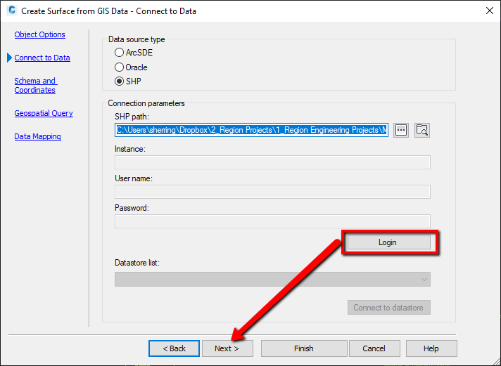
When connecting to a SHP file, select the SHP as the source,
and path to the SHP file. Then select
LOGIN (no username or password needed) and NEXT. On the Data Mapping dialog box, simply map
the elevation attribute to the elevation Civil 3D Property!
It's as simple as that! To learn more about GIS data integration with Civil 3D, click here.
Creating A Surface From Gis Data >>>>> Download Now
ReplyDelete>>>>> Download Full
Creating A Surface From Gis Data >>>>> Download LINK
>>>>> Download Now
Creating A Surface From Gis Data >>>>> Download Full
>>>>> Download LINK tA