A lot of time you will have the need to convert your survey points in Shapefiles to share with other departments or outside users. There is actually a very quick way of doing that inside Civil 3D!! Here are the steps:
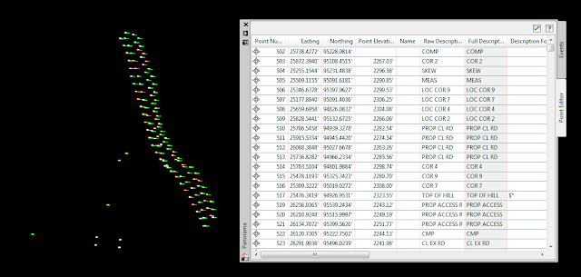
First, insert your survey points into Civil 3D (one of the 5 ways of doing it!!)
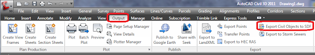
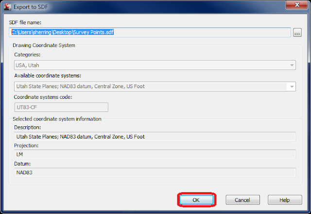
Second, go to the OUTPUT tab on your ribbon, go to the EXPORT panel and select "Export Civil Objects to SDF". The "Export to SDF" dialog box will appear, make sure everything here is correct and the location you choose to save it to is correct. Select OK.
Start a new drawing.
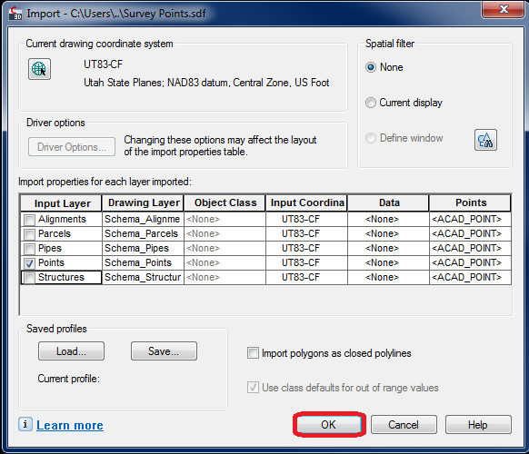
Type "MAPIMPORT" into your command line. This will bring up the Import dialog box, make sure your file type is set to Autodesk SDF. Browse to your SDF file you just created and double click it. The MAP Import dialog box appears, deselect any objects you do not want exported out (i.e. everything except Points). Select OK. Your Points should now be imported as SDF object.
Just one more step!!
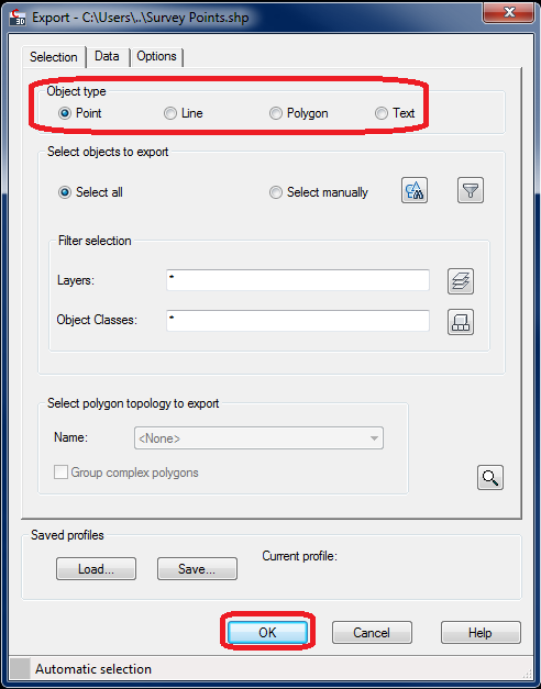
Finally, type in "MAPEXPORT" into your command line. Make sure your file type is set to ESRI Shapefile and choose a file name and location to save this to. Select OK. This will bring up the MAP Export dialog box. Object type is point is this case so ensure that it is selected. Select OK. This will export out a SHP file and all associated files.
That's it!! Now you can import that shapefile or connect to it through the FDO just to make sure everything worked out.
Hope this helps!!
This method does not retain the elevation (z coordinate)!
ReplyDelete